If you have any issues with any of the viewers try clearing your browser’s cache and reloading the viewers.
2024 Regional Plan Maps: Version 4
Adopted December 11, 2025
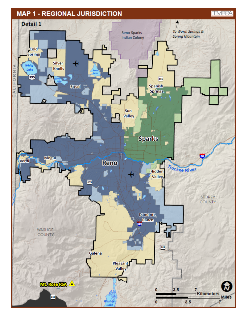
Map 1 – Regional Jurisdiction Map 2 – Regional Form Map 3 – Utility Corridors and Sites Map 4 – Development Constraints Map 5 – Natural Resource Consideration Areas
Archived Maps: PDF maps from prior versions of the Regional Plan are available upon request.
If you need further assistance, please contact us at 775-321-8385 or input@tmrpa.org.
2024 TMRPA GIS Data: Version 4
The following GIS datasets are maintained and published by the Truckee Meadows Regional Planning Agency. These datasets were used to create maps 1-5 of the 2024 Regional Plan. This data or information is being provided for GIS technicians, local planners and the general public for review and analysis of concepts further defined within the Regional Plan. By downloading these data you agree to the terms of our data use restrictions.
Projection: Transverse Mercator, Nevada State Plane Coordinate System, West Zone, (US Feet)
Datum: NAD 83
*To download GIS data pertaining to the Washoe County, City of Reno, or City of Sparks boundaries please visit Washoe GIS Open Data!
Disclaimer: No warranty is made by the Truckee Meadows Regional Planning Agency as to the accuracy, reliability, or completeness of these data for individual use or aggregate use with other data. Original data were compiled from various sources. This information may not meet National Map Accuracy Standards. This product was developed through digital means and may be updated without notification.